The final piece for this project is intended to be an installation piece situated in a public place and requires the use of multiple Bluetooth transmitter / receivers and server
access for data / environment storage. I unfortunately do not have access to this technology at present and therefore the installation is not yet implemented. Due to this lack
of physical work i have "mocked up" some promotional images which can be viewed in the Pictures folder of this cd or on my blog.
The production process involved in making this installation is as follows:
1. Find a space and notify the relevant owner / proprietor of the establishment.
2. Install / mark Bluetooth positions.
3. 3 Dimensional grid survey and photograph the entire space.
4. Retrieve survey data and modify points using grid survey scanner software (Trimble real works survey office).
5. Upload modified survey points as a wiremap in Unreal Editor 3, Produce 3D surfaces and texture.
6. Register points of triangulation ( location of bluetooth receivers).
7. Upload to interaction software (produced in Java) and save on server.
8. Run program.
Production is likely to last approximately a month due to the speed at which 3D imaging surveys and processing can be performed.
Accessible via mobile devices ( limited usability) and laptops / PDAs ( higher functionality).
Evaluation:
This project idea was a bit more comprehensive than i could have managed in the time provided and with limited funds. Unfortunately, although I received feedback about this
issue I could not work out how to produce only a small part of the larger overall project without requiring the whole program.
Thursday 30 April 2009
IDAT 203 - Unreal Editor texturing the world!
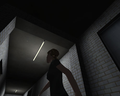
 This is a level design created with the Unreal Editor version 3. Everything here has been created virtually from the undulations of the ground to the dilapidated concrete wall. These are created with modified blocks and planes to construct the shape of the world as you see it.
Transferring the 3D information from the GX scans would be a relatively simple procedure of simplifying the scans to a collection of geometric shapes. Then it can be textured, lit, the collideable surfaces can be registered and any interactive software can uploaded.
IDAT 203 A couple of examples of 3D environments

Here is an example of the wire frame used as the "bones" to which the texture map is the "skin", taken from Igloo - Swan Quake project House :

Images courtesey of Igloo. Taken from Swan Quake
IDAT 203 A couple of examples
Here are a few examples of what could be done with the technology:
Tag somewhere public with the general public being none the wiser.


Redecorate - Virtually.


Tag somewhere public with the general public being none the wiser.


Redecorate - Virtually.


IDAT 203 Possibilities of virtual spaces
Along with the concept of virtually graffiting and / or blogging a virtual space the technology also lends itself to other areas of interest too.
The ability to 3D map entire rooms accurately with current surveying technology such as the Trimble GX survey system means for such great accuracy as to be usable with home improvement, construction work and many other tasks in large spaces which require the ability to view the final product, before or even during the process of construction.
The GX system, which uses a lazer to map a defined grid of points over an entire 3d surface allows a 3d designer to accurately reproduce the entire space in a few days work. The information gathered can even be bolstered with the GX's ability to register the colour of a point and to take photographs of the desired space means that life - like textures can be achived.
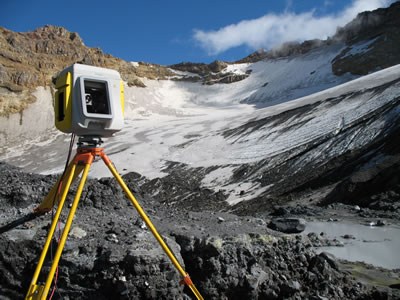


Images courtesy of http://www.trimble.com
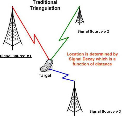
Being a surveying instrument, the GX is capable of taking accurate triangulation points to the nearest 3mm. This would allow me to position Bluetooth transmitter / receivers in the places that offer maximum coverage and record their positions on the 3D map. This would allow for triangulation of a user within the 3D space as well as the physical world ( they would be standing in the same spot in both real and virtual worlds).

Images
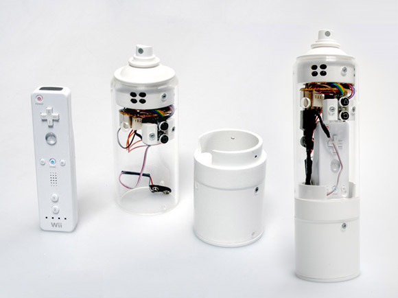
http://www.ubergizmo.com/photos/2007/9/talking-bluetooth.jpg
http://www.directionsmag.com/images/newsletter/2006/04_06/Triangulation_lg.jpg
The ability to 3D map entire rooms accurately with current surveying technology such as the Trimble GX survey system means for such great accuracy as to be usable with home improvement, construction work and many other tasks in large spaces which require the ability to view the final product, before or even during the process of construction.
The GX system, which uses a lazer to map a defined grid of points over an entire 3d surface allows a 3d designer to accurately reproduce the entire space in a few days work. The information gathered can even be bolstered with the GX's ability to register the colour of a point and to take photographs of the desired space means that life - like textures can be achived.
Images courtesy of http://www.trimble.com
Being a surveying instrument, the GX is capable of taking accurate triangulation points to the nearest 3mm. This would allow me to position Bluetooth transmitter / receivers in the places that offer maximum coverage and record their positions on the 3D map. This would allow for triangulation of a user within the 3D space as well as the physical world ( they would be standing in the same spot in both real and virtual worlds).

Images
http://www.ubergizmo.com/photos/2007/9/talking-bluetooth.jpg
http://www.directionsmag.com/images/newsletter/2006/04_06/Triangulation_lg.jpg
Virtual Graffiti
Virtual Graffiti consists of virtual objects and/or digital messages, images, multimedia or other annotations or graphics applied to public locations, landmarks or surfaces such as walls, train stations, bridges, etc. Virtual Graffiti applications utilize Virtual Reality and Ubiquitous Computing to anchor Virtual Graffiti to physical landmarks or objects in the real world. The virtual content is then viewable through devices such as personal computers, set-top boxes or mobile handsets, such as mobile phones or PDAs. The virtual world provides content, graphics, and applications to the user that are not available in the real world. Virtual Graffiti is a novel initiative aimed at delivering messaging and social multimedia content to mobile applications and devices based on the location, identity, and community of the participating entity.
Ref:Wikipedia - Virtual Graffiti http://en.wikipedia.org/wiki/Virtual_Graffiti
Wiki references from http://tagging.us/html/pr.html
Ref:Wikipedia - Virtual Graffiti http://en.wikipedia.org/wiki/Virtual_Graffiti
Wiki references from http://tagging.us/html/pr.html
Another related concept is the cell phone graffiti screens (citylights / large lcd screen) being developed by Mark Ecko so that anyone with a bluetooth phone can draw whatever they like or any witty expletive phrase on a surface that will, for all intents and purposes be completely non-permanent, just by using the cursor of their mobile.

Subscribe to:
Posts (Atom)